2019 - Public Land, Private Hands
Between 2000 and 2008, authorities in Kyrgyzstan divided up a large swath of Ataturk Park in the country’s capital, Bishkek, and handed it out to 173 people — many of them wealthy and well-connected.
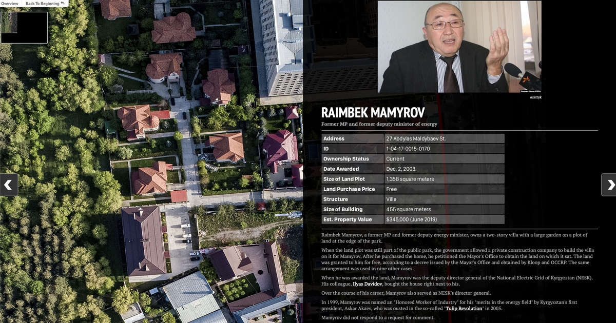
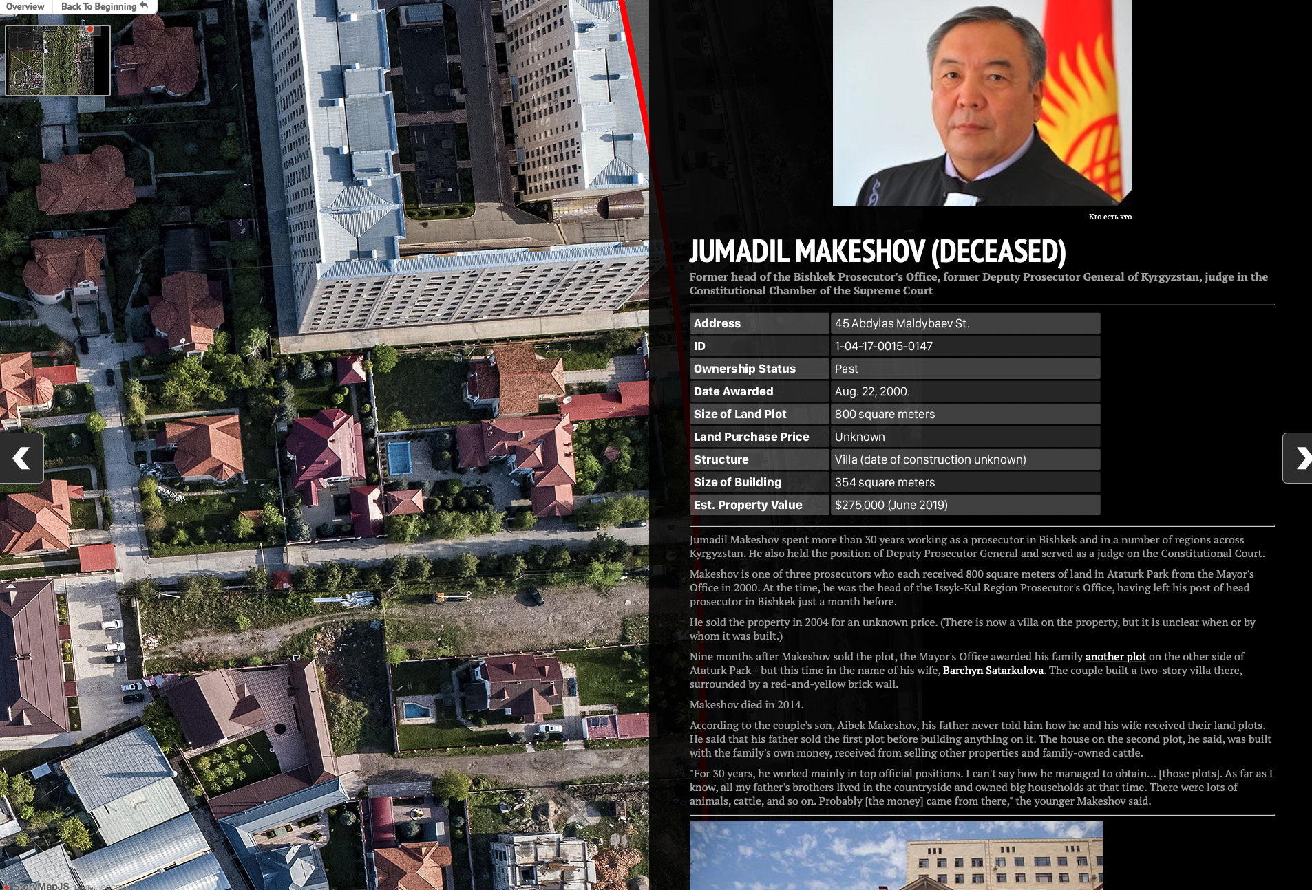
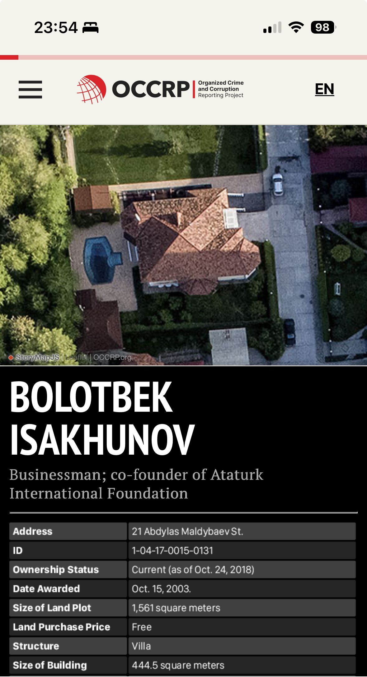
I was tasked to create an interactive presentation showing what the park looks like today and whom each newly built house belongs to, with their location, profile picture, details and additional documents proving their ownership.
Using satellite photos (from Google maps or otherwise) was out of question due to low resolution and inconsistent imagery, so we flew a drone above the park at 300 meters altitude and made a series of aerial images. Using Photoshop, these images were compiled into one big map, similar to Google Earth, but with far more detail.
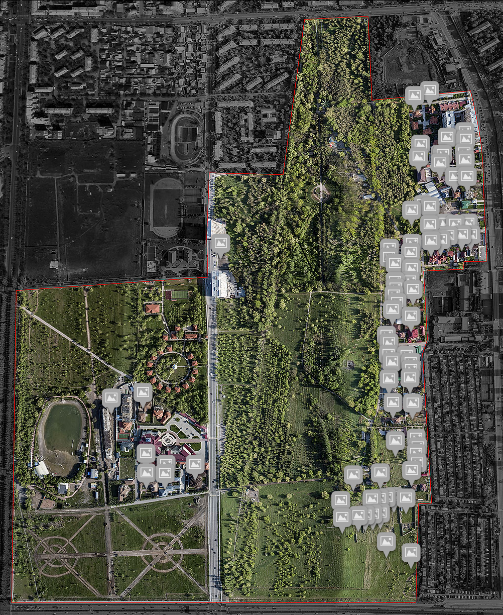
This composite image was then converted into a tileset to be used as an interactive map with dynamically loading tiles, depending on which part of the map user is currently viewing (so that they don't have to download the whole 150 MB image down to computer).
Using Storymap.js framework, this was turned into an interactive web presentation that lets users click on locations indicated on map, which zooms on specific location and shows the owner of the building.
For mobile screens, the presentation was adjusted to show map on top and informations on bottom, but keep the same interactivity.
To see this project in action, click on the link below.